Thai Nguyen is located in the northern midland and mountainous region. The province covers a total area of 837,453 hectares, formed through the merger of the former Thai Nguyen and Bac Kan provinces. It enjoys a favorable geographical position and abundant natural resources.
A corner of Thai Nguyen Province’s provincial center
1. Geographical Location
Thai Nguyen is located in the northern midland and mountainous region. The province covers a total area of 837,453 hectares, formed through the merger of the former Thai Nguyen and Bac Kan provinces and shares its borders as follows:
- To the north: bordering Cao Bang province
- To the east: bordering Lang Son province
- To the south: bordering Bac Ninh province, Hanoi city and Phu Tho province
- To the west: bordering Tuyen Quang province
Thai Nguyen province comprises 92 administrative units, including 15 wards and 77 communes under its direct jurisdiction.
2. Topography
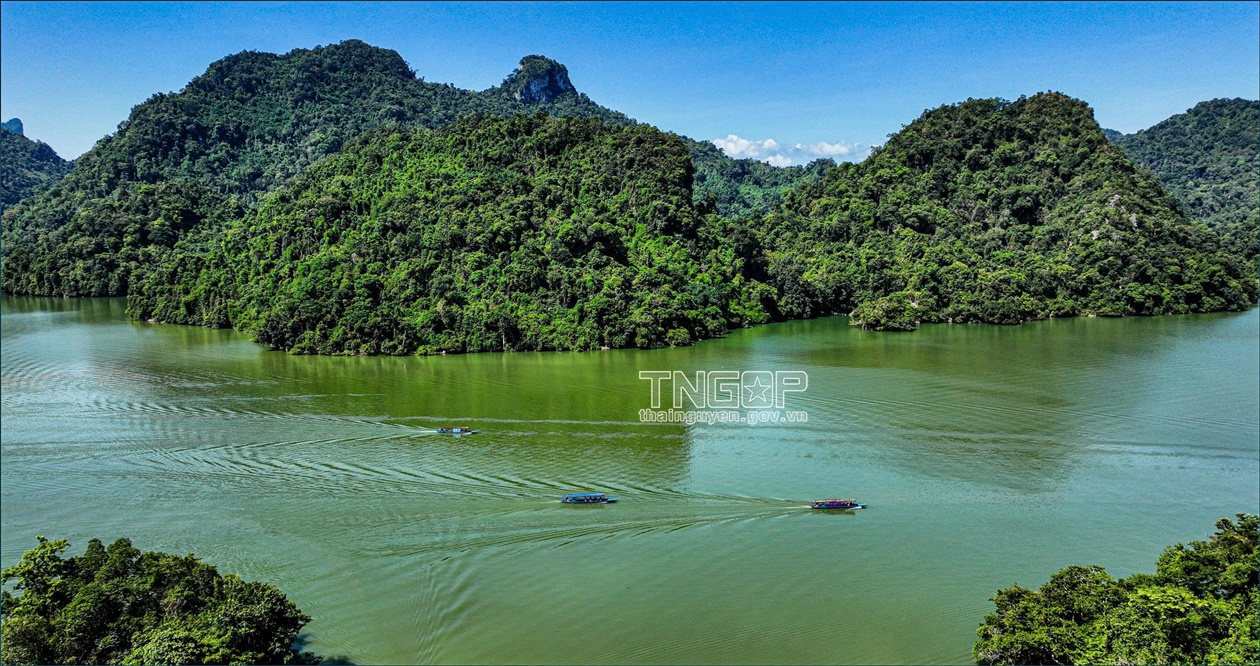
Thai Nguyen is a mountainous and midland province with highly diverse terrain. The former Bac Kan area is characterized by high mountainous terrain, elevated above surrounding provinces, with arc-shaped mountain ranges dominating the landscape. The Ngan Son arc range extends continuously from the south of Cao Bang province southward along the eastern side of the former Bac Kan area to the north of the former Thai Nguyen area, forming a clearly defined arc; this range includes numerous high peaks, such as Coc Xo Peak at 1,131 m above sea level in Con Minh commune. The Gam River arc range extends along the western side of the former Bac Kan area, where Phja Bjooc Peak at 1,575 m stands as the highest point in the former Bac Kan area, with many other peaks exceeding 1,000 m. Between the two arc ranges lies a synclinal depression belonging to the river valley system. The terrain of the former Bac Kan area is divided into three zones: to the east, the Ngan Son arc range represents the most typical arc range of the northeastern region, with a relatively homogeneous geological composition primarily suited to forestry development; to the west lie massive high mountain blocks; and in the central zone along the Cau River valley, the terrain is comparatively lower.
The terrain of the former Thai Nguyen area consists primarily of low hills and mountains running in a north-south direction. To the southwest lies the Tam Dao mountain range, with its highest peak reaching 1,591 m. To the north, the Ngan Son range extends from the former Bac Kan area down to Vo Nhai, alongside the Bac Son range oriented in a northwest-southeast direction. For reference, the predominant elevation of the former Bac Kan area ranges from 200 to 600 m. The former Thai Nguyen area encompasses three topographic zones: mountainous terrain to the west and northwest, mountainous terrain to the east and low-lying terrain below 100 m extending from Nam Phu Luong southward. To the east, a massive limestone massif stretches from La Hien to Bac Son, together with large limestone blocks at Than Sa and Phuong Giao. Phu Binh and Pho Yen districts consist predominantly of river valley plains and low hills. Valley-floor plains and agricultural fields are distributed across Vo Nhai and other northern areas of the former Thai Nguyen area. Intermontane plains can be found at Van Phu and Trai Cau. Slopes of 4 to 8 degrees account for much of the area of Phu Binh and Pho Yen districts, while the typical gradient across the former Thai Nguyen area is 16 to 25 degrees; limestone areas have very steep gradients and can approach near-vertical slopes of almost 90 degrees. In the former Bac Kan area, slopes exceeding 15 degrees account for 83.76% of the total natural area. In that area, low-lying, relatively flat strips of land are interspersed among the hills and mountains, such as the Nam Cuong and My Thanh plains.
Thai Nguyen boasts rich and diverse natural resources (illustrative photo)
3. Climate
The climate of the former Bac Kan area varies according to altitude and the orientation of mountain ranges. Summers are hot and rainy, while winters are cold and dry, under the influence of the northeast monsoon. The average annual temperature in the former Bac Kan area ranges from 20 to 22°C, with the lowest temperatures ever recorded being -0.1°C in the former Bac Kan city and -0.6°C in the Ba Be area and -2°C in the Ngan Son area. Mean annual temperatures may exceed 22°C in the Cau River valley and in areas below 200 m elevation. Average temperatures in the former Bac Kan area range from 25.7 to 27.5°C in July and drop to between 12.1 and 14.4°C in January. Locations above 1,000 m may experience temperatures of 10°C or lower. The former Bac Kan area is subject to prolonged frost, severe cold and damaging cold spells that significantly affect crops and livestock. The average annual sunshine duration in the area is 1,555 hours, approximately 100 to 150 hours less per year than in the Red River Delta, with winter months recording only approximately 55 to 60 sunshine hours. The local climate is well-suited to the cultivation of certain subtropical and temperate crops.
Rainfall in the former Bac Kan area is relatively low compared to other northeastern provinces, due to the sheltering effect of the two arc ranges — Ngan Son and the Gam River arc range. Mean annual precipitation ranges from 1,400 to 1,600 mm, concentrated primarily in the summer months. The hot and humid rainy season lasts from May to October, accounting for 70 to 80% of annual rainfall; the dry season runs from November to April of the following year, contributing only approximately 20 to 25% of annual rainfall, with December being the driest month. The average relative humidity across the former Bac Kan area is 84%. The Na Ri and Ba Be 3 areas receive comparatively less rainfall. Because hilly and mountainous terrain predominates in the former Bac Kan area, air circulation is limited; combined with high atmospheric humidity, evapotranspiration from vegetation is minimal, at approximately 900 mm per year.
The climate of the former Thai Nguyen area represents a transitional zone between the lowland plains and the mountainous uplands. Diurnal temperature variation is approximately 0.5 to 1°C greater than in the Red River Delta. Rainfall is generally heavier than in the plains, while wind speeds are lower. The mean annual temperature is approximately 22 to 23°C, falling to 20°C in hilly and mountainous areas at around 600 m elevation. Mean temperatures drop below 17°C from December to February; in areas above 400 m, up to five cold months may be experienced. January is the coldest month, with average temperatures of 15 to 16°C in lowland areas and below 12°C in mountainous zones. The lowland areas have five months with mean temperatures exceeding 25°C, with July being the hottest month. In mountainous areas, the hot season lasts only three months; in high-altitude zones such as Tam Dao, no month records a mean temperature above 25°C. The average annual sunshine duration in the former Thai Nguyen city area is 1,690 hours; the province experiences overcast skies in winter, with sunshine reaching only 30% of summer levels. Each year, the area records 20 to 30 days of high-humidity southerly airflow (a phenomenon known as ‘nồm’, characterized by condensation moisture on indoor surfaces), with approximately 12 such days in March alone. Hot and dry westerly winds originating from the Bay of Bengal affect the former Thai Nguyen area on several days between May and July.
Mean annual precipitation in the former Thai Nguyen area ranges from 1,600 to 1,900 mm, with the Phu Binh area in the southeast receiving as little as 1,450 mm. The eastern part of the area is noticeably drier than the west. The foothills of the Tam Dao range in the former Thai Nguyen area receive over 2,000 mm of annual precipitation — higher than the western slopes of the same range due to steeper terrain and windward exposure. Monthly rainfall in July and August typically exceeds 300 mm and surpasses 400 mm in windward mountain zones. Rainfall from May to October accounts for 85 to 90% of annual precipitation, while the remaining months record only 200 to 400 mm. Most of the former Thai Nguyen area has three to four dry months per year, with Phu Binh having as many as five. Mean annual relative humidity in the area is 82 to 84%. Among the northern mountainous provinces, only the former Thai Nguyen area exhibits a relatively distinct dry season in November and December. The Vo Nhai and Phu Binh areas frequently experience frost toward the end of December. Strong winds occur in the west of the former Thai Nguyen area in April and May and in the east in January and February.
4. Natural Resources
4.1. Land Resources
Blessed by nature with a favorable climate and fertile land, Thai Nguyen province holds considerable potential for developing agriculture, forestry, industry, tourism and other service sectors. The province's total agricultural land area is 753,620 hectares, accounting for 89.99% of its natural land area, of which 597,894 hectares are designated for forestry use (including 413,773 hectares of production forest). This constitutes a significant advantage for developing raw material forests to supply artificial timber processing and paper pulp manufacturing. Beyond staple food production, the province also has a relatively large area available for the development of pastureland and intensive livestock farming, including dairy cattle. Notably, Thai Nguyen province is particularly well-suited to tea cultivation, with Tan Cuong tea standing out as a specialty product that has long enjoyed renown both domestically and internationally.
4.2. Mineral Resources
Thai Nguyen's mineral resources are rich and abundant
- The former Thai Nguyen area is assessed as having the second-largest coal reserves in the country, comprising coking coal and hard coal, concentrated in two areas: the former Dai Tu district and the former Phu Luong district. Coking coal potential is estimated at over 15 million tons, of which explored and surveyed reserves amount to approximately 8.5 million tons of relatively good quality, concentrated at the Phan Me and Lang Cam mines.
Anthracite coal has total explored and surveyed reserves of approximately 90 million tons, concentrated at the Ba Son, Khanh Hoa and Nui Hong mines.
- The former Thai Nguyen area possesses a variety of metallic mineral resources, including:
+ Iron ore: 47 mines and ore deposit points have been identified, including two large mining clusters — the Trai Cau iron mine cluster with reserves of approximately 20 million tons and an iron (Fe) content of 58.8% to 61.8% and the Tien Bo iron mine cluster located along National Highway 17 with total ore reserves of approximately 30 million tons.
+ Titanium ore: 18 mines and mineral deposit points of placer and primary ore have been identified, distributed mainly in Phu Luong and Dai Tu areas; one mine has been explored and is currently in production (Cay Cham mine, Phu Luong). The primary mineral component is ilmenite, with total estimated reserves of approximately 18 million tons.
+ Tin: Found at three mines in the Dai Tu area — Phuc Linh, Nui Phao and Da Lien; total combined reserves of these three mines amount to approximately 13,600 tons.
+ Tungsten: Located at Nui Phao, Dai Tu; reserves amount to 110,260,000 tons.
+ Lead-zinc: Concentrated at Lang Hit (former Dong Hy district); Than Sa and Cuc Duong (former Vo Nhai district); deposits are of modest scale.
+ Gold: Includes placer gold deposits in the Than Sa area; the Bo Cu mountain range (former Vo Nhai district); and the Ngan Me and Cay Thi areas (former Dong Hy district).
+ Other metallic minerals include copper and mercury, among others, all with small ore reserves.
+ Non-metallic minerals: Include pyrite, barite and phosphorite, among others. Noteworthy is the presence of phosphorite at several deposit points: Nui Van, Lang Moi and La Hien. Total reserves amount to approximately 60,000 tons.
The former Thai Nguyen area is endowed with abundant construction materials minerals, most notably cement clay at two mines — Cuc Duong and Khe Mo — with combined reserves of approximately 84.6 million tons. Carbonate rocks, including construction limestone, cement limestone and dolomite, are found in numerous locations. Construction limestone alone has reserves of approximately 100 billion cubic meters, with the three mines of Nui Voi, La Hien and La Giang holding reserves totaling 222 million tons. In addition, a kaolin clay deposit of good quality and high Al₂CO₃ content has recently been discovered in Phu Lac commune, with estimated reserves of 20 million cubic meters. This constitutes a rich raw material base for the development of the construction materials industry, including cement and cladding stone production.
- Former Bac Kan area: Due to the territory's position within two geologically distinct structural types with differing geodynamic regimes, the former Bac Kan area possesses relatively diverse and characteristically rich mineral resources. To date, 101 mineral mines and ore deposit points have been identified in the area, concentrated mainly in Cho Don, Cho Moi, Ngan Son, Bach Thong and Ba Be areas. The mineral resource potential of the former Bac Kan area can be classified into three groups:
- Fuel minerals: Anthracite coal has been discovered in the Nghia Ta area.
- Metallic minerals: Include gold, lead, zinc, iron ore, tin and manganese. Among these, gold, lead, zinc and iron ore hold the greatest potential, concentrated in the Cho Don, Cho Moi, Bach Thong, Ngan Son and Ba Be areas. Metallic minerals constitute one of the key strengths of the former Bac Kan area and are of national significance.
+ Lead-zinc: 70 mines and ore deposit points have been identified, with projected resources of approximately 3 million tons, distributed mainly in the Cho Don, Ngan Son and former Pac Nam areas.
+ Iron and iron-manganese: 15 mines and ore deposit points have been identified, with projected resources of approximately 22 million tons, distributed across the Cho Don, Ngan Son and former Bach Thong areas.
+ Gold: 17 mines and ore deposit points have been identified, with projected resources of approximately 39 tons, distributed across the Ngan Son, Cho Moi, Bach Thong, Na Ri, Ba Be and former Pac Nam areas.
+ Antimony: Primarily ore deposit points of limited reserves, located in the former Yen Cu area.
+ Tin: Projected resources of approximately 2,385 tons of tin (Sn), distributed in the Cho Don area (Lung Chay) and the Ngan Son area (Na Deng). Non-metallic minerals: Industrial minerals in the former Bac Kan area include kaolin, graphite, dolomite and other industrial minerals, though reserves are limited. Graphite has been discovered thus far only in the former Cao Ky and Phien Gie areas (former Bach Thong area) and Na Lang (former Ba Be area).
- Construction materials minerals: The former Bac Kan area is rich in construction minerals, including marble, granite, building stone, clay, crushed stone, sand and gravel, limestone, quartz, brick clay and cement clay. The most significant resources include cement limestone at 150 million cubic meters; white stone and quartz at approximately 460 million cubic meters; and cement clay exceeding 10 million cubic meters.
Overall, Thai Nguyen province possesses a highly diverse range of mineral resources, many of which are of national importance. This endows the province with a significant competitive advantage in the development of metallurgical and mining industries, with a view to developing into one of the country's major metallurgical centers.